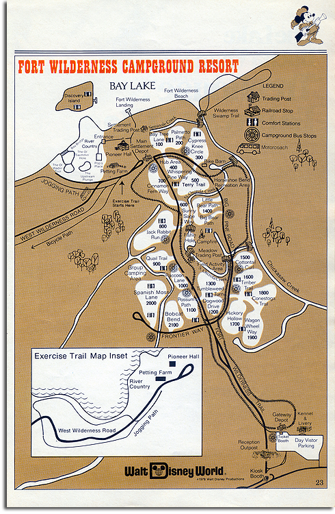
Oh, this is a good one:
For some time now, I’ve looked for a map that would illustrate the path of the now-legendary Fort Wilderness Railroad with any degree of detail. It’s a route that is poorly known today, having been abandoned long before the days of ubiquitous home videos, Flickr and YouTube. Thanks to our previous articles on the railroad, we receive a lot of traffic from people searching for a map of the route; apparently it’s something that a lot of people are curious about!
This is the wonderful Fort Wilderness of 1978. There’s River Country, shown in detail, as well as Discovery Island. Compare this map to Fort Wilderness in 1988; much less had changed in that decade than has changed since. But now the next time you head out to explore the wilds of Fort Wilderness, you can do a little Disney archaeology and trace the trail of the late, lamented Fort Wilderness Railroad.


The train was the real attraction for the park. Without it, it really isn’t worth visiting.
Oh, I still love Fort Wilderness dearly. It’s still a slice of ’71. But the train *would* really tie the room together…
Michael,
In one of the videos you linked to, it showed a playground area from the train. Do you know where that was?
The Horseshoe Bend Recreation Area? The Petting Farm?
Awesome map…
[…] Michael Crawford at Progress City, USA has scanned a 1978 map of Ft. Wilderness. […]